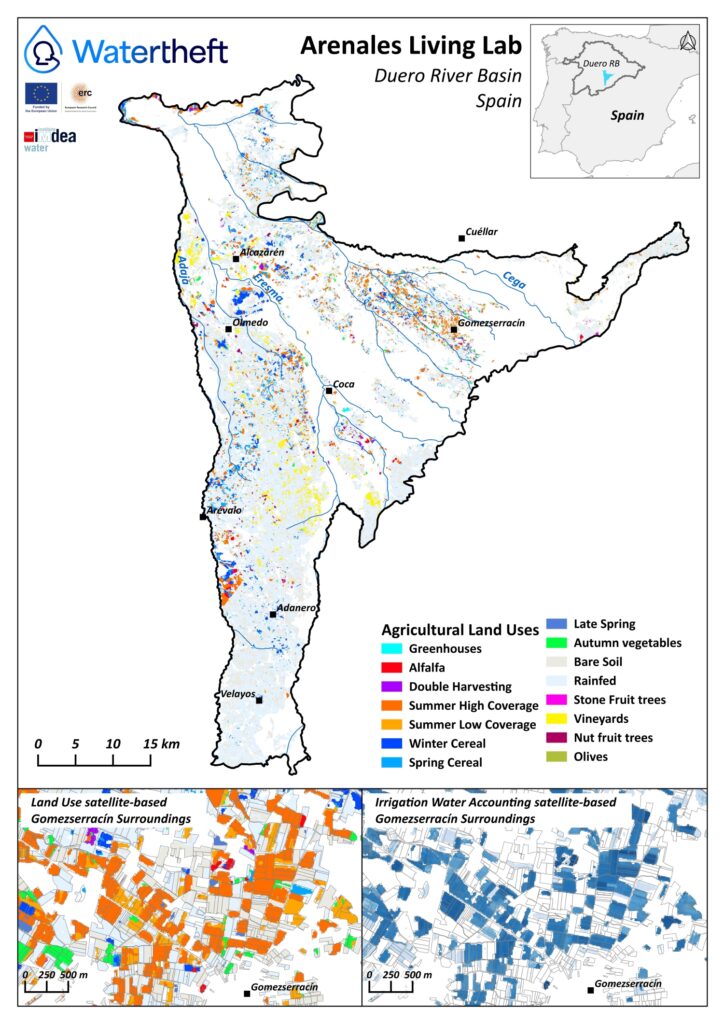
The Arenales Aquifer living lab – with around 2,200 km² (Douro River Basin District, Spain) – presents about 115,000 ha of agricultural activity where almost 13,000 ha are considered as irrigable by the latest River Basin Management Plan. While the groundwater is the main water source, the irrigation activity is the main water user, basically developing vegetable and cereal crop types.
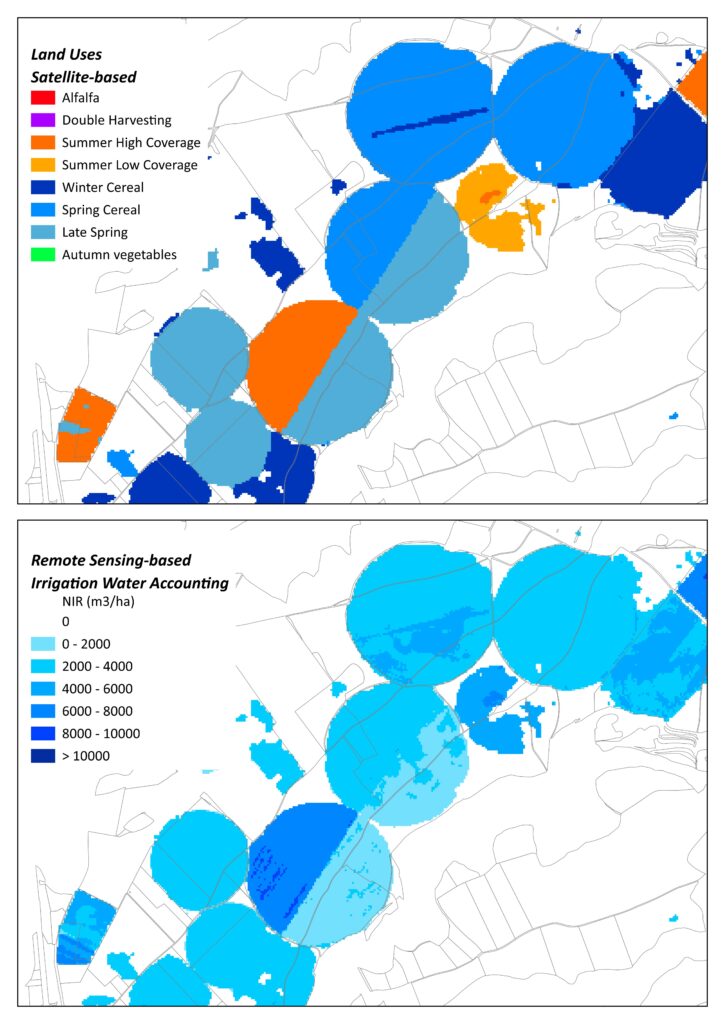
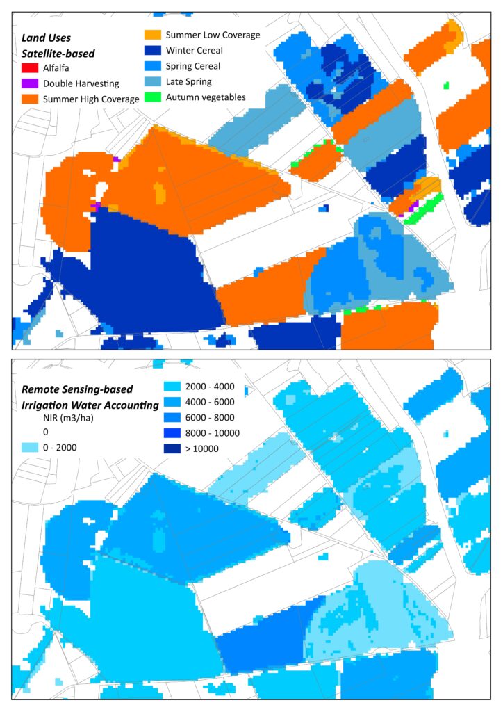
Within the general WaterTheft goal of developing a novel approach to forecast adaptation surprises in complex human-water systems, the own-developed Remote Sensing-databases on irrigated land uses and irrigation water accounting provide a local, spatial and temporally distributed knowledge that feeds the subsequent WaterTheft’s models.