To estimate remote sensing-based crop adjusted evapotranspiration (ETcadj-RSb) and Net Irrigation Requirements (NIRRSb) over certain geographical, political or water management areas, a Remote Sensing-based Soil Water Balance (RS-SWB) is developed along the study period, normally during an irrigation campaign.
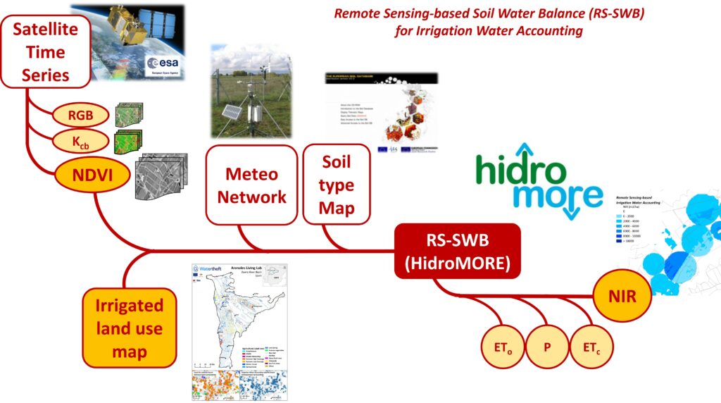
The methodology briefly consists of including crop type/group pixel-based VI time series into the FAO56 methodology to estimate crop water consumptions and irrigation requirements at pixel-based scale and daily frequency time scale. The software that supports the RS-SWB is called HidroMORE. To support RS-SWB, the approach benefits from local knowledge on soil type maps, irrigated agriculture classification and agroclimatology conditions.